
Far south of the familiar rings of the Maldivian atolls, a solitary island rises steeply from the depths of the Indian Ocean. Fuvahmulah stands apart from its neighbors, not as a lagoon-framed crescent of reef, but as a single, uplifted platform of ancient coral limestone. There is no lagoon here—no shallow interior to soften the ocean’s force. Instead, the open sea presses directly against the land.
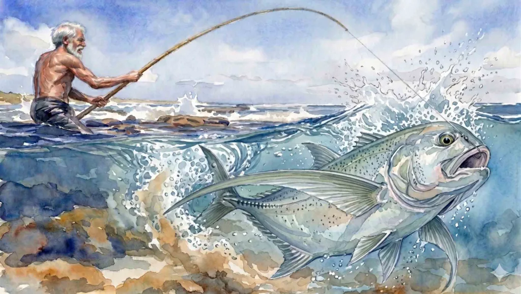
This absence shapes everything. With no sheltered lagoon for fishing, islanders have long turned outward, working the reef front—known locally as elhevado—and the exposed shoreline itself. At the southern end of Fuvahmulah, along this boundary where land and deep ocean collide, one of the island’s most distinctive features emerges: a network of narrow coastal channels and sea caves known as Horongo. For centuries, these same reef-front channels have also been places of work. Fishing on the ocean-facing reef was carried out on foot, beyond any lagoon protection, with fishermen moving across the exposed reef and into the surge zones to cast their nets before returning to the beach with their catch.
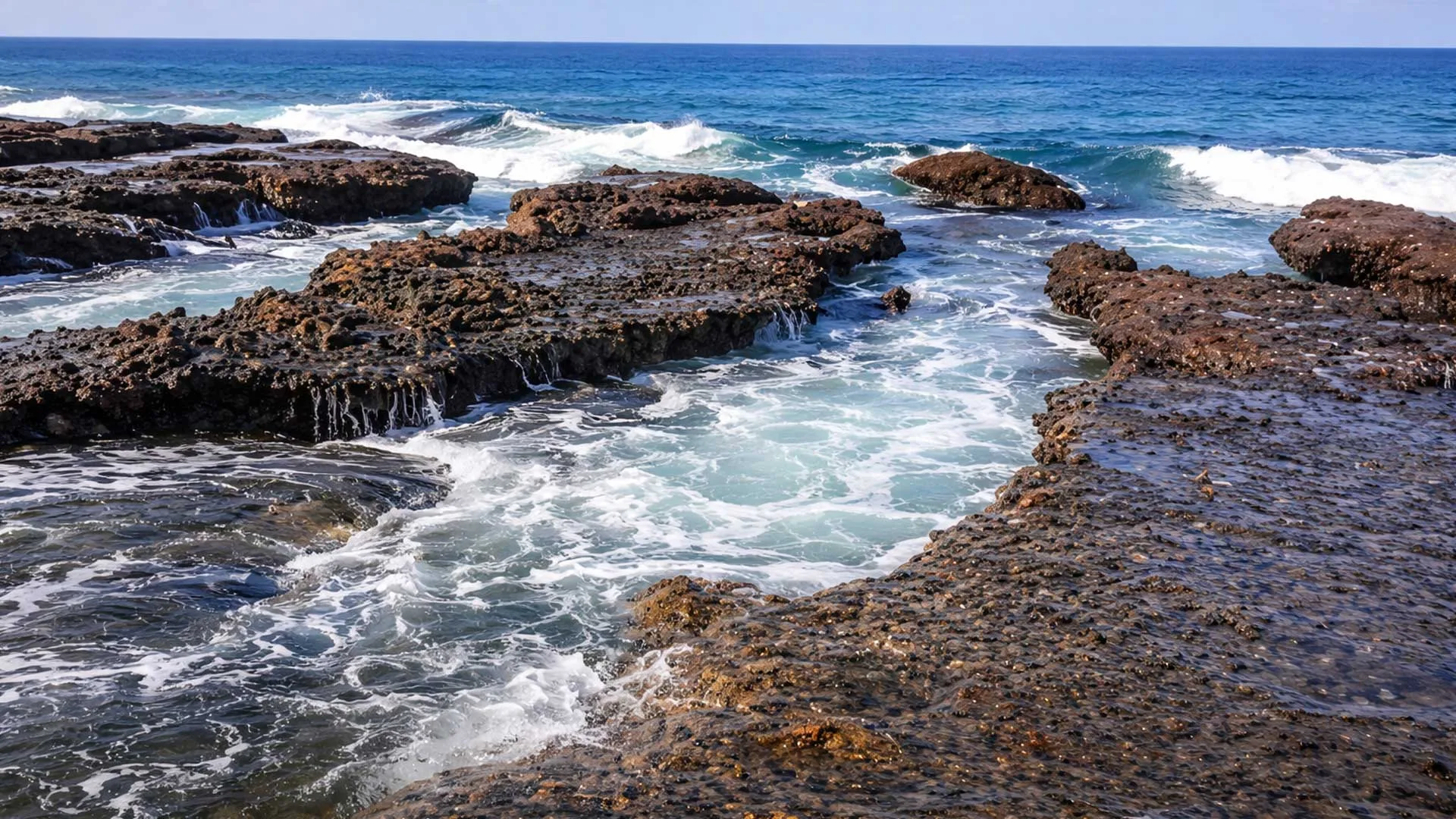
Where the Ocean Breaks the Land
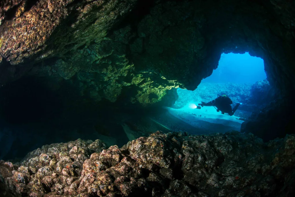
In the footage above, Indian Ocean swells surge into jagged fissures along the shoreline, vanishing briefly into the rock before erupting outward in white spray. These are not calm grottos or protected inlets. They are high-energy conduits—pathways carved by relentless wave action into uplifted reef limestone.
The Horongo are shaped primarily by hydraulic weathering. As waves strike the coast, water and air are driven into microscopic fractures in the porous coral rock. When the wave retreats, compressed air expands explosively, prying the stone apart grain by grain. Over millennia, this repetition transforms hairline cracks into deep channels and interlocking sea caves that lace the island’s perimeter.
While they resemble spur-and-groove systems found on reef slopes elsewhere in the tropics, Fuvahmulah’s Horongo are sculpted in the intertidal zone—where uplifted limestone meets direct, unbuffered oceanic force. Here, erosion operates at full intensity.
A Living Fishery in the Surge Zone
For centuries, these same channels have also been places of work.
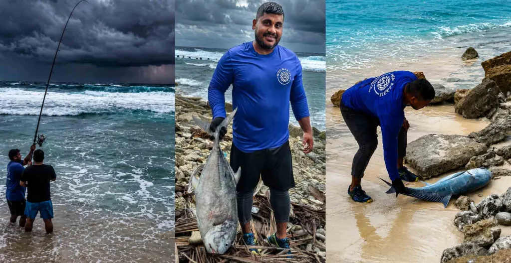
During low tide, when the sea briefly loosens its grip, people have long entered the Horongo to fish the reef front directly. Generations of islanders learned to read the surge, the rock, and the timing of the tide, harvesting reef fish from one of the most dynamic environments on the island.
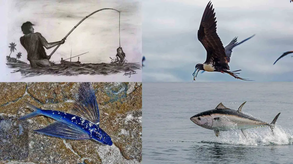
Among the species traditionally caught are squirrelfish, snappers—including humpback and bluestripe varieties—goatfish, trevally, and the sixfinger threadfin. The tools were simple but finely adapted to the terrain. Early fishermen used short rods cut from Alexandrian laurel or bamboo, paired with meyvaali—fishing lines made from plant fibers or cotton. Bait was gathered locally: hermit crab meat, octopus, or small cut pieces of fish.
Fishing in the Horongo demanded patience and precision. Waves could surge without warning, and footing was never secure. But the same violent water that made the channels dangerous also concentrated fish, drawing life in from the reef edge and the open ocean beyond.
The Oxygen Engine of the Coast
As waves are forced through these narrow passages, water accelerates dramatically. Constricted flow increases turbulence, churning seawater into froth and entraining air. This constant mixing produces an oxygen-rich environment—hostile to the unprepared, but ideal for species adapted to chaos.
Small crustaceans and reef fish shelter within the rock’s crevices, benefiting from both high oxygen levels and protection from larger predators unable to navigate the surge. Ecologically, the Horongo function as natural aeration systems, injecting oxygen and nutrients from the deep ocean directly into the coastal zone.
To stand beside one during a heavy swell is to feel the island breathe—each wave a pulse, each retreat an exhale.
Knowledge Carried on Sound
Long before GPS or modern weather forecasts, the Horongo also served as instruments of prediction. Master fishermen, known as Keyolhu, listened to the sound of waves detonating inside the channels. Subtle changes in pitch, rhythm, or echo could signal a shift in the prevailing season or condition of the sea and weather, or the approach of a distant storm, long before it appeared on the horizon.
In local folklore, these roaring passages were thought to be thresholds. The Horongo were said to mark entry points for Dhevi, spirits believed to move between the deep forereef and the land. Dangerous, powerful, and unpredictable, the channels occupied a liminal space—where nature, labor, and belief converged.
Fast Facts: The Horongo of Fuvahmulah
Fast Facts: The Horongo of Fuvahmulah- Geology: Uplifted reef limestone with cemented coral conglomerates
- Energy Zone: High-energy intertidal coastline
- Primary Processes: Hydraulic weathering, wave erosion, bioerosion
- Traditional Use: Low-tide reef-front fishing
- Local Terms: Horongo (sea channels/caves), Neru (passages), Elhevado (reef front)
On Fuvahmulah, the ocean is not held at bay. It is met directly—worked, listened to, and respected. The Horongo stand as the physical record of that relationship: places where geology, ecology, and human survival have been shaped by the same relentless force, wave after wave.